Tuesday, March 3, 2015

3/4: WINTER STORM on its way for the I-65 Corridor

TONIGHT: Its the plain 'ole liquid Rain Showers for several of us through the Overnight.
   ** As of 11PM Central, most of the rain is situated along and South of the Ohio River.  The rain-shield will slowly shift South, as a few could hear a rumble of Thunder during the Overnight with some Heavier Showers forming in the muggy, mild Mid 60°s Airmass ahead of the Cold Front.  

** DO YOU SEE the Changeover in Missouri?  The Snow/Sleet will slowly trek South as the Arctic Air moves in Wednesday.


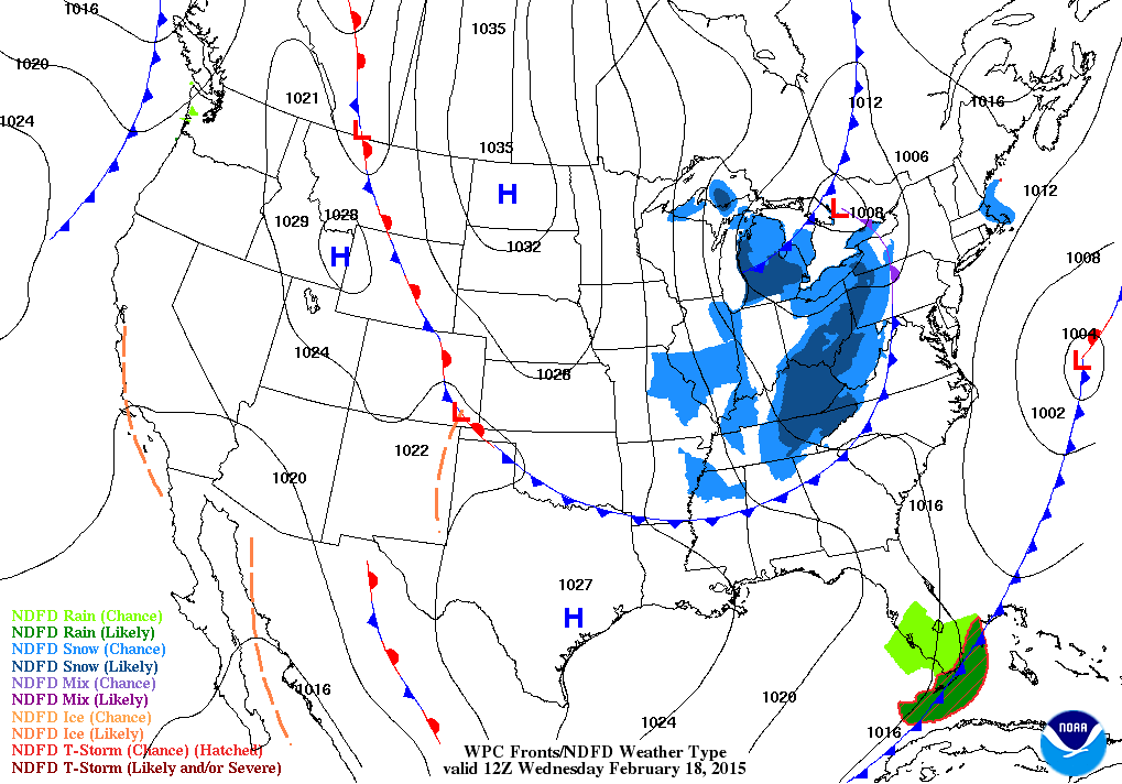
WEDNESDAY:  It will be a day full of Transitions...from  Precipitation and Temperatures.  Everyone will see a "Cold Rain" through the Morning and Early Afternoon Hours.  
  - Bowling Green should see the changeover from Rain to Sleet by Late Afternoon-Early Evening. As for the Snow timing, looks to be all Snow as early as 9pm..but right before Midnight is a good time frame.  Periods of Moderate-Heavy SNOW should increase through the Overnight Hours. Snow should lighten up by mid-morning THURSDAY and turn drier little after Noon.

- Nashville will experience the "Transition" a little later than Bowling Green, being a little warmer than Bowling Green.  ALL RAIN through the Morning, Afternoon and Early Evening Hours as of right now.  Wintry Mix/Sleet looks to change over between 9PM-12AM, I do expect "Lots" of SLEET for MiddleTN/Nashville as the Warm Air profile may support in the mid-levels; I think this is where the Boundary Stalls.

AMOUNTS: * via 0z Evening Data

-- The "Heaviest" band of Snow via GFS is carving right across Central KY (6-10") and lesser amounts farther South into Middle TN.

-- As for Middle TN, looking to be 1-3" amounts in Nashville Area through Thursday late morning


-- Here is the NAM Model.  Its showing quite aggressive amounts more than the GFS.  I think they may be adding some Sleet Amounts.

IF this verifies, your looking at a swath of over a FOOT from Paducah-Louisville-Lexington.

At least 6-12" for Southern KY, and a Few Inches for MiddleTN.


RPM Model, however, is certainly an Outlier for any Snow Lover in KY.  Hardly anything (1-3") as where the Snow drops South into our area of Middle TN (3-6").  Hard to take this one in account,  but we have to watch trends IF any of the other models drop South.


ONE MORE THING...

I also use the Iowa St Meteogram that provides Ranges from Models and includes the NWS thoughts for certain cities.  Here is what the Meteogram suggests...

Nashville: 1-3" (Snow); 1/3"- 2/3" (Sleet);  .10"-.20" (Freezing Rain)
Bowling Green: 4-9" (Snow); .25"-.50" (Sleet); .10"-.25" (Freezing Rain)
Louisville: 6-12" (Snow) ; .20"-.40" (Sleet)

** I think the worse of the Snow will stay North of Middle TN into KY once again.  Freezing Rain doesn't look as threatening though, since i think there will be "not as much" warmer air in the Mid-Levels.  Sleet will be the worse but a 1-3" is possible for much of Nashville Area..and 2-5" for Northern Tier of the State.  ***

Sunday, March 1, 2015

3/1: "Roller Coaster Ride" on the Way.

Happy Meteorological Spring Folks! Its March 1st.  Many celebrate the Vernal Equinox on March 21st as the 1st Day of Spring..but it will feel like Spring just for one Day on TUESDAY, then WINTER returns in a hurry by Wednesday.

Im calling this an Eric Church Special...join me as we are on his "Roller Coaster Ride".

* By the Way, I am a huge EC Fan of his non-mainstream country approach about life, family and what Country music is about.  He's our Country Music Jesus.
 
The Outsiders album has a song for this Blog Post Them...
Click HERE -- Roller Coaster Ride to Listen.


OKAY, back to the Forecast Folks.

MONDAY looks to be fine...maybe a little "Black Ice" in the Morning as any leftover moisture could drape on the bridges and overpasses for the morning rush.


TUESDAY will be "Warm Day" as we'll likely see a Warm Front move in spreading rain chances in he Morning.  Some breaks in the clouds could allow the winds increase; few Isolated showers cant be ruled out in the Afternoon.  Lots of Warm Air Advection out of the Southwest will allow Temps to warm in the Mid 60°s at night in Nashville/Middle TN area as Lower 60°s for Southern KY.

** NOT a Tornado threat folks for this one at Night. Winds in the Upper, Mid, and Lower levels are forecasted to blow from the Southwest so no Wind Shear (changing of winds in direction in height) will likely not happen at this time.


  Storms should fire up as the "Low Level Jet" increases and provides some Gusty Winds and Heavy Rainfall with this one through Late Tuesday and Overnight Wednesday as the Cold Front passes.

** Right Now, it looks like the Front will drop through Southern KY and Middle TN and stall out along the way ( not moving much)


WEDNESDAY:

This will be a very hard forecast since the Timing, Precip Amounts, and Track is still up in the Air.
- The "Potential" is there for someone to see another 6" of Snow..and Sleet/Freezing Rain threat too.
- The Guidance Models are up in the Air at this time so no consistency is having it tough to track this storm.

WHAT WE KNOW:  
1)   A Front will stall in the OH/TN Valley allowing Colder Air to push in with a new Low forming from the Southwest to ride along spreading Wintry Weather.
2)  Late Morning/Early Afternoon start on the Wintry Mix changeover and Light Snow for many on Late Afternoon Wednesday as most of the Snow will exit us after 6AM Thursday...(pushing East towards the Plateau)


<< The Short-Range Ensemble has a swath of 4"+ of Snow that is very High (50% or more) right through Middle TN and Southeastern KY.

The SREF was fairly accurate who was going to see that 8"+ swath 2 weeks ago in Southern KY, so we may have to watch these trends in next couple days.


*** The Potential, as stated, is there, for a Big Snow (6"+) in our Area again.  However, a Bust is possible as like many Southern Storms, it can Shift slightly North.  A 50 Mile difference can make a large difference. Plus, where will the Front stall plays a factor of where the "Snow Zone" sets up for the larger amounts. ** 

Tuesday, February 24, 2015

2/24: 10PM Tuesday Snow Update for WEDNESDAY/Thursday

Okay, so the very latest Evening Data from the GFS, NAM, and even the RPM showed some changes. (SNOW Lovers, NOT your Blog Post to Read from )

1. RPM:  Earlier this Afternoon, it showed some "moisture" arriving in from a Rain/Mix to Light Snow through Early Thursday Morning.  RIGHT NOW, the SnowDome turned on tonight keeping any Snow along the Southern 1/3 of TN, and anything Along & East of the Plateau.  It keeps rest of TN Dry....dry....arid...scarce :(


2. NAM:  This Model Guidance still showed some changes as compared to the Morning Run data.  Earlier it showed snow developing from 3-6PM Wednesday...now the storm has slowed down making the Snow want to begin now 6-9PM all across Middle TN.  It will, as stated in previous post, a quick hitter.  After Midnight, the Snow should be tracking towards the Plateau.

NAM Amounts:
 * Trace-1" for Nashville
*  2"-3" for South/Eastern TN


3. GFS:  Nothing much to go in-depth with the GFS.  Its agreeing alongside with the NAM from this Evening for Tracking, Timing and "lack" of Intensity for MiddleTN.  Its prefers the "Southern Track" keeping the better Snow Amounts in Southern 1/3 of TN and much of Eastern TN.  But it does have the Timing like how the NAM plays out for Nashville; beginning around 6-9PM and then moves Eastward after 1-3AM Thursday.

GFS TOTAL SNOWFALL
** Only thing I see different it keeps Southern KY drier than the NAM.  This will NOT be a Heavy Snow event, maybe some "Flurries" for Bowling Green with a Dusting if best.


GFS AMOUNTS:

Nashville: Dusting - 1"
South/Eastern TN:  2-4" 


THOUGHTS:
  -- Little under 24 hours away from start of the event, but we have to watch the Short-Range Data by Morning (SREF, HRRR) before the event begins.  I do think if the Track stays "on course", expect Lesser Amounts like a Dusting to 1" for Nashville area...and Higher Amounts farther South and East you travel.

*** DISCLAIMER:   There have been times where a System "jogs" North about 50-75 Miles right before the Storm moves in.  IF (a big IF) this happens, I may bump the amounts a little Higher, which could see our Timing a little faster (4-7PM)..not (6-9PM)  We will see!


2/24: MORE SNOW...on the Way by Weds PM

Lets get right down to the Details, so I won't spare you the details on how Tuesday was...so lets get right into the next SNOW Potential for Middle TN and Southern KY.

This will NOT be a High Impact Storm for Southern KY, as most of the Snow & Moisture will stay mainly along and S of the TN/KY Line. 

Winter Weather Advisories are up in Middle TN along and East of I-65 via NWS Nashville. 
Higher Amounts could be slightly South where a Winter Storm Warning is for Southern Tier of TN.


TIMING:  Looks to be a Late Wednesday Afternoon through Overnight Wednesday into Thursday Morning. It will be a quick hitting storm for only 12 Hours as most of the Snow will be along and East of the Plateau by 6AM Thursday; clearing and drying out much of Middle TN.


 << Initial Start could be a little bit of Light Rain as Temps will hover around Low-Mid 30°s.

** TEMPS and Cloud Cover will depict the timing of the Snow; If a little warm, could see rain 1st then the Changeover... if not, mainly all snow.

** Also, so far the Models have been fairly consistent of the Track. I do think the Heavier Snow Amounts could stay to the Southeast in the Appalachians and Carolina's as the core of the Low will scoot along the Atlantic. 

    -- However...if any Evening Data rolls around tonight with the Low moving Faster in progression and deepens, that 'may' impact the Storm with Amounts, Timing and Temperatures.  Right Now, I don't see it.  NWS Nashville has their Snow Amounts as of right now.  Not so much for Southern KY, but up to an Inch or so from Bowling Green.


Any New Data suggests something differently tonight, I will make a new Post.

My Forecast Calls for this ~
-Nashville Area:  1/2" to 2"
- S & E of Nashville: 1-3"
- Southern TN:  2-5"


Tuesday, February 17, 2015

2/17: Tuesday PM "SNOW Arrives again and ARCTIC Tundra Temps"

Despite a Cold Day all around, TUESDAY saw ample amount of Sunshine allowing the Ice and Snowfall to melt across Middle TN and Southern KY. The final Snow Reports for KY are official.  Central KY received the most in that Isol'd Heavier band from Leitchfield to Richmond.

** Here is the Current Radar as of 10PM Tuesday as the Front moves in with the Snow to our Northeast.


OVERNIGHT PM/ WEDNESDAY, however, will be our "next" Arctic Blast and this will be the Dagger so far this season, on top of our Snow/Ice on Monday and yes another round of Light snow for much of the Region.
So far, it looks like ~ 1-2" for much of KY and up to an Inch or so in Middle TN.

This will be a very surface High building in from the Plains as it drops through Wednesday Night into Thursday Morning.  "COLDEST AIR  of the Season in quite some time." Some model forecasts are showing Central/Southern KY about -7 to -15° & Middle TN anywhere from 0 to -7° along the Plateau.  I don't think it we will reach "all-time" Record Low, buttt, Record Low likely for some just for the Date with these Temps.  I think some spots may see Colder what the Models suggest given Clear Skies, Light winds, and fresh Snowfall on top of the Snow on Monday ~~ pretty much, it will Stink!


THURSDAY/FRIDAY will stay Cold for Highs and even for Lows on Thursday Night into Friday Morning.
** Unsettled for the Upcoming Weekend as we will experience a "new" system emerge again from Texas spreading moisture to the Northeast in the OH/TN Valleys once again.  Right Now, looks to be not as extensive like the previous storm, but a mix of Snow/Sleet early could then lead into some Rain.  Not expecting a large amount of Wintry Mix, but most of it will melt once the transition changes on SATURDAY.  Both Models tonight so far, (GFS & NAM) got a good grasp of this storm.


-- Warm Air will advect in the Region keeping our Temperatures from the Mid Level to the Surface enough to provide Rain, AND   so far the Low is forecasted to be in favor for us to see a rainy setup; as the Low will stay West of the Appalachians.  --

Monday, February 16, 2015

2/16: POST STORM Recap...COLD Weather Looms

WHEW... What a MONDAY many experienced.  Personally, I have not experienced this much Winter Weather since I was forecasting out in Casper, WY.  Though we had more snow, but the craziness i saw on TV, reports on Social Media was getting bad.
** This was back in October '13 where the city received 16" and I forecasted actually 10-16" the night before.  Weight of the Dense snow toppled the Trees and many broke on power lines; several power outages as this was one Casper's Top 10 Snows.


HOW MUCH Snow fell in KY? Here's a map that shows who received what and it clearly shows where that zone of banding that draped South of the WK/BG Parkways and into parts of South-Central KY.

SNOWFALL RATES were pushing up to 1-1.5"/HR this Morning and Early Afternoon in the pink and white shadings so it will be a snow (much of Southern KY) will remember for a long time.
- However, some parts near Louisville received some Drier Air i mentioned about last night from the Upper Levels so their amounts were lower. Highest Amount i saw was 13" in Richmond and 12" in Richardsville (Warren County; N of Bowling Green)

MIDDLE TN this Morning and Early Afternoon received some other precipitation type: Sleet & Freezing Rain.
The Northern Tier of the State, however, did receive Moderate Snowfall upto a Foot or more since their Temps were cold enough from the Column to the Surface to support Snow.

WHY this Mix Bag of Precip?  It all depends on the Amount of 'Warmer' Air aloft above the Surface.  Sleet has a lesser amount of Warmer Air above the Surface once the snow falls then melts, then goes back to Ice Pellets once it hits the surface.  FREEZING Rain is where its Snow...Rain once its melted and leaves the Cloud and then since the Concrete/Surfaces are already cold, it "Freezes" on Contact.
  ** About 1/4" to 1/2" of Ice Accumulated in Middle TN where some heavier bands dropped Isolated Spots of 1/2" to 3/4" of ice. That's serious damage to Trees and Power Lines!

-- TONIGHT, expect any Precipitation to diminish by Midnight. Skies will clear out and Winds should die down as Temps will drop in the Teens.

TUESDAY:  COLD...Highs only in Upper Teens/Lower 20°s for Southern KY and Lower to Mid 20°s for Middle TN and Nashville.

WEDNESDAY looks to be another Cold Day as a "new" weather maker arrives as a Trough drops through bringing Snow Chances. Not a large amount, but a nice coating is possible by Early-Mid Afternoon
  ** The latest RPM (shown below) wants to drape some Snow Squalls for the Afternoon and IF any develop, expect a quick Dusting or so of Accumulation through the Evening Hours.


These will be small bands, so who will see what is still hard to tell since they are little Microscale challenges.


THURSDAY MORNING will be Frigid!...like the Frozen Tundra Cold.. I think many Forecast Models will not handle the Lows due to the Snow Pack and Ice all over the Region.

*Since my Internet was disconnected I Am finishing this post by Phone. *
Ignore any Models you see, but I think much of KY will drop anywhere from -5 to -15 (Isol'd spots -15 to -20) of deep snowpack.
Middle TN will likely fall between anywhere from near 0 to -10 in some isolated spots.
IT WILL BE COLD. Bundle Up and bring in the Animals.


Sunday, February 15, 2015

2/15: WINTER STORM on its way...

COLD Morning for many as the Mercury dropped in the Lower Teens for much of Southern KY and Middle TN. Highs for SUNDAY will crack only in the Upper 20°s for SoKY and Lower 30°s for Middle TN with Dry and Partly Sunny conditions as Clouds will increase this Evening

TONIGHT, conditions will deteriorate after 10PM as our Weather maker comes into play.  However, some "dry air" may work in as our Humidity and Dew Points will need to take some time to rise as the Temperatures drop.  Longer we have Drier Air, Snow Amounts will drop.. THAT will be the factor.

Right Now:  Winter Storm Warnings are in effect for all of Southern KY and MiddleTN through late Monday Night.
Note how this Storms stretches a good chunk of the MidSouth and even up towards the Mid Atlantic too.  It will begin late this Afternoon to our West in MO/AR and then through Monday Morning, it will crank up in our Region.


Some Models still aren't agreeing the timing but you got to expect it since the Low is still in WY/CO as it'll travel South and East into the ArkLaTex later tonight.  I think the Evening Data will be much better to work with.  NAM and GFS are suggesting the best start time somewhere late tonight and early Monday morning.  Here is the GFS's Timing and Snow/Sleet Track


The Short-Range Ensemble Forecast showed astounding Snow Potentials in %'s with 8"+ and 12"+ for Southern KY.  Haven't seen amounts like this in many years.

** This shows you the "Percentage" of 8"+ for Southern/Central KY but not so much for Middle TN.  I think Middle TN could be on the fence as 'sleet' could accumulate too.


** For some of you in KY, this could be a Snowfall some haven't seen in about a Decade.  I think the Highest chance of seeing that Foot, will be in Southeastern KY near the Mountains where Upslope could take shape up.

So far, this is an "Over-Running" event where bands of moisture will pour heavier amounts in isolated spots.


Showed this Earlier, but my thoughts on the amounts are close to what the RPM is suggesting
-- Southern KY:  6-10" (Isolated 10-12")
-- Middle TN:  3-8" (Sleet may mix in so these totals could drop)  Plateau: 5-10"


Once the Newest data arrives from the Evening Runs, I'll post later tonight.  As for rest of the Day, stay warm and take any precautions and stock up if needed.


Tuesday, February 3, 2015

2/3: COLD and Snow Chances coming up

Lots of Sunshine amplified those Temperatures in the 40°s this Afternoon as we stayed Dry and we stay dry this Evening as lows will drop in the Upper 20°s/Lower 30°s across MiddleTN and SoKY.

SNOW AMOUNTS for Late Weds- AM Thurs
 
Dusting - 1/2" in MiddleTN/SoKY
WEDNESDAY will be warmer for all of us with Highs ranging in the Low to Mid 50°s with Increasing Clouds for the Afternoon as our next "Arctic Front' drops through with Snow Chances late in the Evening.  NOT expecting widespread snow, but I think most of us will see the snowflakes that could continue very early in the Morning on Thursday for the morning commute.


THURSDAY for the rest of the Afternoon will see decreasing clouds as the Front passes as Highs will only hover 'maybe' in the Low-Mid 30°s.

FRIDAY will be the 1st day of our rebound of Seasonal Temperatures and staying dry with High Pressure building in the Southeast. But the good news is this...SATURDAY will be much warmer with HIGHS in the Middle 50°s before our next weather maker arrives SUNDAY with rain chances.

Monday, February 2, 2015

2/2: 6 More Weeks of Winter continue AND Evening Forecast

Well I posted earlier today, BUT the Groundhog told us more winter is ahead.  In hindsight, Meteorological Spring starts March 1st.  :)

Middle TN and Southern KY did see some snow showers this early morning about 1/4" - 1/2" fell as all of it Melted past Noon.


TONIGHT will stay Cold and Dry with clearing skies as Lows should drop in the Low-Mid 20°s.


TUESDAY and WEDNESDAY will stay dry as Temperatures will rebound; as Wednesday we could see Highs climb near the Middle-50°s.  LATE Wednesday into Thursday Morning will be an Arctic Front dropping through.  This front is still about 48 Hours away, so the Timing is still Uncertain with Accumulations.  SO FAR, they look light as a Dusting- 1/2" is possible (at this moment).  Models are trending to diminish this activity after Noon as Colder Air ushers in on THURSDAY AFTERNOON.


Tuesday, January 27, 2015

1/27: Tuesday PM Weather Talk

Before I go in depth into Tonight's forecast, remember this Weather Event?  Yeah, we had Snow in KY, but the worse impact was the crippling Ice Storm along the Western KY Parkway where 1-2" of Ice piled up.  One of the worse and costliest states disasters we experienced.
via NWS Louisville


WHEW... What a Cloudy, Cool, Raw, Ugly, Gloomy, Dry, Blahhh day for many of us.  I don't know what other amazing Adjectives to describe our Tuesday. Even a few Snow/Sleet showers popped up late Afternoon, early Evening across our Area.

But wait... we have the chance to see that nice ball of Sunshine for our WEDNESDAY folks.  That'll help our diurnal heating warm up back in the Middle-40°s


THURSDAY will be a touch Warmer for all in the Lower-Mid 50°s, but our next Frontal Passage from the West will swing in bring another round of Rain Showers in the Afternoon.


WEEKEND STORM???  

Last night I mentioned, how the Canadian Model showed the SNOW Chances.  Guidance Models have shifted more North as the Low from Texas is trending to race in the Ohio Valley. IF a Low is on top us, chances likely it will be rain and Snow North of the Ohio River in IN/IL/OH.  Plain 'ole Rain for much of MiddleTN and Southern KY during the day on Super Bowl Sunday if your going out to watch the game, but may get a little 'dicey' late after the Game.

There is a chance we could see some "Light Accumulations" late Sunday into Early Monday on the back side as the Cold Air ushers in IF there is enough Moisture left.  Best Snow potential looks to be in KY at this time, but its a Forecast...we have to watch Trends from now through Saturday.


Monday, January 26, 2015

1/26: A "Clipper" returns with Snow Chances

TONIGHT appears to be another unsettled evening Precipitation wise as Cooler Air is already ushering in with Temperatures as of 5:00PM in Nashville at 36°   Another Clipper will drop through with Light Snowfall with very minor accumulations through Saturday Morning.  The latest HRRR depicts upto a Dusting to 1/2" across MiddleTN and SoKY.  May be a "heavier" band but upto and Inch can't rule out in the Plateau by daybreak tomorrow.


TUESDAY AFTERNOON through WEDNESDAY looks rather Calm and Dry with Temperatures staying in the Middle 40°s as of right now with the latest data and my Forecast.


THURSDAY  will be our next Rain Chance as Frontal Passage moves in.  Not a big rain chance, but enough to throw one in :)

**SUPER BOWL SUNDAY SNOWSTORM ??????  ***
   This storm has been hyped up for a couple weeks already..1st as a Severe Weather event in mid-January now to a SNOW Storm for the Ohio/TN Valleys.  I am still NOT buying into it yet, However.. one Model (Canadian) is blasting about 6-12" in Central/Southern KY and a few Inches in Middle TN.  Its a "classic storm/Low track" as a Low rides to our South in Dixie and feeds Moisture in the area with Dynamic Cooling.
-- Remember, this is NOT A Forecast, and being 120 hour out..Two other models (GFS & Euro) is less aggressive.  I do think IF there is a Snow chance, it could be in Central/Southern KY right now. 

Tuesday, January 20, 2015

1/20: Rain Chances then SNOW Chances "looming" ?

Not a bad Tuesday for our Region as we experienced another Mild afternoon, but clouds increased as our Next weather maker will impact us late Tonight.  Its only a small 20-30% chance, BUT I think anywhere I-40 and points North could see a sprinkle little after Midnight.


WEDNESDAY/THURSDAY  Looks to be fairly "tranquil" and dry with zonal flow some seasonal Temperatures in the Upper 40°s/Lower 50°s, but the System from the West will slide into TX; thus that will setup our Wintry Chance come late Friday

And speaking of FRIDAY, looks to be a Rainy afternoon for much of Middle TN & Southern KY.
 However, the very latest Model guidance suggests a Rain to Rain/Snow then SNOW late Evening.
  - An area of Low Pressure in the Gulf is forecasted to strengthen along the Coast and some "cooler air" on the back side can create the right ingredients for some Light Snow across Middle TN and the Plateau; even through Southern KY too.


*  Though this is the 18z Run (doesn't show Upper Air Data), the 12z Run showed the changeover.

- Monday's data didn't show much of the moisture into TN, but its worthy of watching through Thursday.  The Low will strengthen as it churns along the Gulf Stream. 


SATURDAY could see a few stray Flurries across Middle TN as the system departs Eastward, but staying Dry and Cool.

SUNDAY will start off Dry and Cool, BUT a "Clipper" is possible as it drops from the Midwest into the TN/OH Valleys by the Overnight. TOO long ways to discuss but Model Guidance varies beyond 3 days.